National Parks Map and Image Gallery
Use GDAL, Flickr, TurfJS, and Leaflet to build a really awesome National Parks map.
This application and its accompanying tutorial are our tribute to National Park Week (Apr 18-26). A working knowledge of QGIS, Leaflet, Turf.js, jQuery, Bootstrap, Lightbox, and Flickr API are required to build out this application using this tutorial.
Data Acquisition and Conversion/Getting Required Modules
To get started, the first step is to download the national parks boundaries dataset and save to your working directory. Load the shapefile into QGIS to view and, in this case, simplify geometries due to the file size. To accomplish that in QGIS, select Vector -> Geometry Tools -> Simplify Geometries.
Next, using command line and in our working directory, convert the shapefile to GeoJSON using GDAL. In this case we entered:
ogr2ogr -f GeoJSON <output geojson> <input shapefile>
To create the application, we will define our dependencies in our package.json file:
"dependencies" : {
   	"turf" : "*",
   	"leaflet" : "*",
   	"bootstrap" : "*",
   	"jquery" : "*"
  	}
Then, using command line, use npm to add the appropriate packages locally.
npm install
You will see your packages in a new directory called node_modules inside your project folder.
In your .gitignore file, add node_modules, and they will be left out when pushing to your GitHub repo.
Building the Application
Below is an outline of the steps taken to build out this application, along with some code and image samples. Dig further into the source code for more information.
-
add a Leaflet basemap
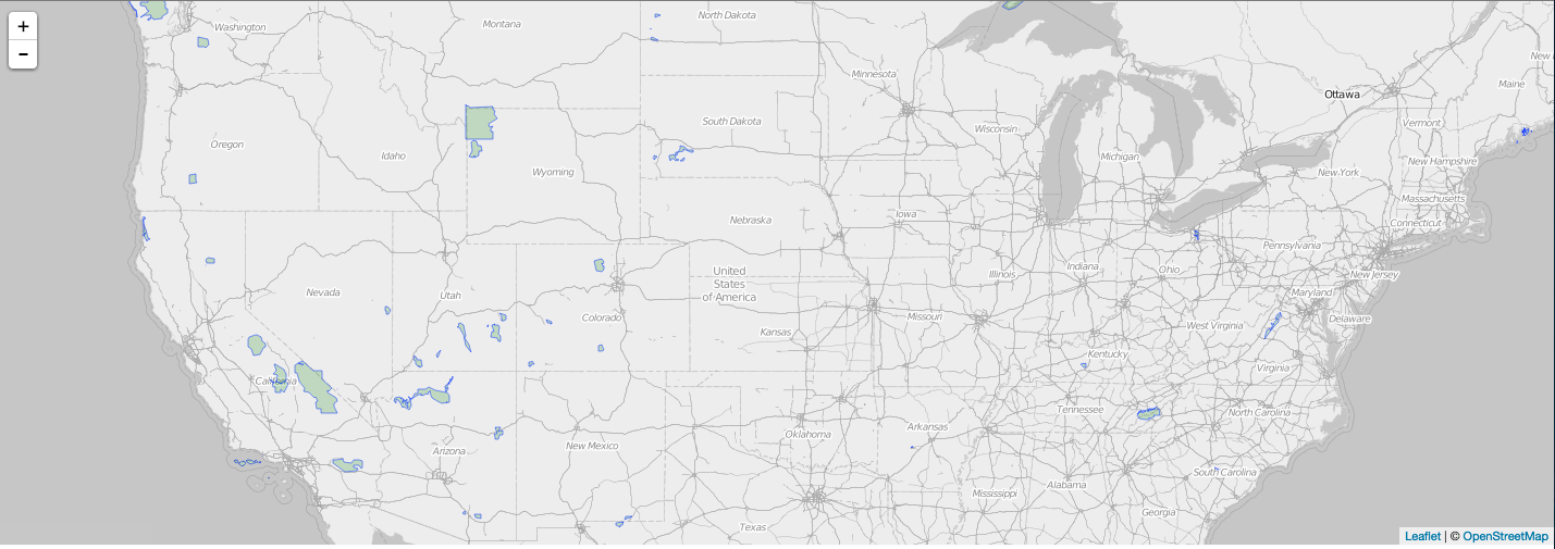
var map, // main appliation map basemap; // leaflet basemap layer var app_config = { basemap : "http://{s}.tiles.wmflabs.org/bw-mapnik/{z}/{x}/{y}.png", basemapAttribution : "© <a href=\"http://www.openstreetmap.org/copyright\">OpenStreetMap</a>" }; // create map and add tiled basemap map = L.map('map').setView([40.12, -98.57], 4); basemap = L.tileLayer(app_config.basemap, { attribution: app_config.basemapAttribution }); basemap.addTo(map); - filter features to exclude geometries that aren’t parks (rivers, monuments, etc.)
-
setup GeoJSON layer style
var np_boundaries, // raw geojson np_geo; // leaflet geojson layer // filter geojson to only parks np_boundaries.features = $.map(np_boundaries.features, function (val, i){ if(val.properties['UNIT_TYPE'] == 'National Park') { return val; } }); function style(feature) { return { weight : 1, color : 'green', fillColor : 'green' } } -
setup Flickr configuration
// Flickr Configuration var flickr_config = { maxNumImages : 4, // max number of images to request for each park url : "https://api.flickr.com/services/rest", key : <your flickr-provided key> }; -
add GeoJSON to map along with initial Flickr images
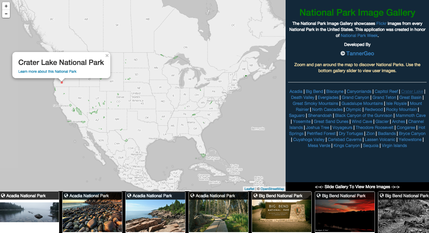
  /* GEOJSON LAYER */
  np_geo = L.geoJson(np_boundaries, {
      style : style,
      onEachFeature : function (f, l) {
          var pn =  f.properties['UNIT_NAME'] + " National Park";
          l.bindPopup(
              "<h3>" + pn + "</h3>" +
              "<a href='http://en.wikipedia.org/wiki/" + pn.split(" ").join("_") +
      "' target='_blank'>Learn more about this National Park</a>", {
              autoPan : false
          });

      }
  });
  np_geo.addTo(map);
  getImages(); // make inital call once
-
add events for extent change
// setup map events map.on('moveend', function (e) { getImages(); }); -
acquire bounding boxes and park name tags in preparation for Flickr API calls (uses Turf.js)
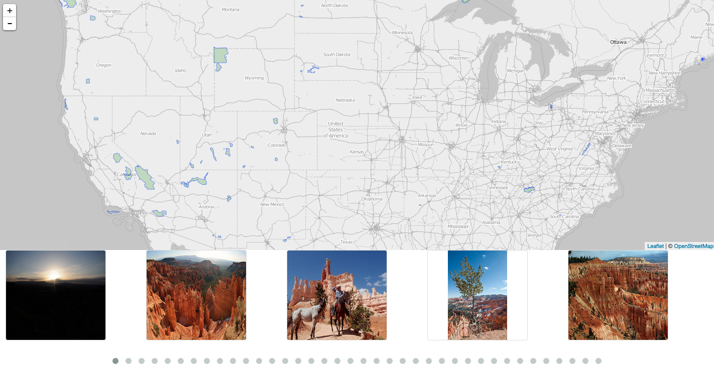
var queue = []; // placeholder if need for queue and digest management var cached = {}; // cache park images to limit api calls var current_gallery = {}; // images and details in current extent var current_req_length = 0; var queue_length = 0; function callFlickr(f, parkName) { var bbox = turf.extent(f.geometry).join(","); var tags = parkName.split(" "); tags.push("park"); tags.push("national"); tags = tags.join(","); $.ajax({ url : flickr_config.url, dataType : 'json', data : { api_key : flickr_config.key, tags : tags, bbox : bbox, format : 'json', method : 'flickr.photos.search', per_page : flickr_config.maxNumImages, nojsoncallback : 1 } }).done(function (resp) { queue_length += 1; if(resp.stat !== "ok") { if(queue_length == current_req_length) { buildHtml(parkName) } return; } var photos = []; $.each(resp.photos.photo, function (i, v) { photos.push("https://farm" + v.farm + ".staticflickr.com/" + v.server + "/" + v.id + "_" + v.secret + "_n.jpg"); }); // add to cache cached[parkName] = photos; current_gallery[parkName] = photos; if(queue_length == current_req_length) { buildHtml(parkName); } }); } - get current extent and clear current gallery
-
calculate the # of matches for image queue and make Flickr API calls
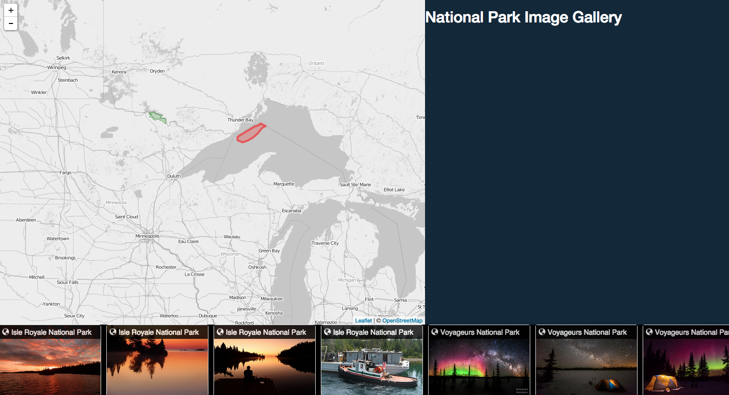
function getImages() { // get current extent var mapBounds = map.getBounds(); var centroid; // clear current gallery current_gallery = {}; current_req_length = 0; queue_length = 0; // calculate number of matches for queue $.each(np_geo.getLayers(), function (i, l) { // get centroid of layer centroid = turf.centroid(l.feature); var latlng = L.latLng([centroid.geometry.coordinates[1], centroid.geometry.coordinates[0]]); if(mapBounds.contains(latlng)) { current_req_length += 1; } }); // Make flickr calls $.each(np_geo.getLayers(), function (i, l) { // get centroid of layer centroid = turf.centroid(l.feature); var latlng = L.latLng([centroid.geometry.coordinates[1], centroid.geometry.coordinates[0]]); if(mapBounds.contains(latlng)) { if(l.feature.properties['UNIT_NAME'] in cached) { // push existing parks with images current_gallery[l.feature.properties['UNIT_NAME']] = cached[l.feature.properties['UNIT_NAME']]; queue_length += 1; if(queue_length == current_req_length) { buildHtml(l.feature.properties['UNIT_NAME']); } } else { callFlickr(l.feature, l.feature.properties['UNIT_NAME']); } } }); } - add events for mouseover, mouseout, and click (uses Lightbox)
-
build html for image carousel
  function highlightStyle() {
      return {
          weight : 4,
          color : 'red',
          fillColor : 'red'
      }
  }

  function highlightPark(park) {
      var park = park;
      $.each(np_geo.getLayers(), function (idx, layer) {
          if (layer.feature.properties['UNIT_NAME'] == park) {
              layer.setStyle(highlightStyle());
              layer.openPopup();
          } else {
              layer.setStyle(style());
          }
      })
  }

  // build html for image carousel
  function buildHtml() {
      var gallery_items;
      var gallery_container = $("<div />", {
          id : 'owl-slider',
          class : 'own-carousel'
      });
      var list = [];
      $.each(current_gallery, function (park, photos) {
          list.push("<a class='park-item' href='' target='_blank'>" + park + "</a>");
          $.each(photos, function (idx, photo) {
              var div = $("<div />", {
                  class : 'thumbnail'
              });

              div.on('mouseover', function (e) {
                  highlightPark(park);
              });
              div.on('mouseout', function (e) {
                  $.each(np_geo.getLayers(), function (i, l) {
                      l.setStyle(style());
                  });
              });

              var title = $("<span />", {
                  html : "<h2><span class='glyphicon glyphicon-globe inverse'></span>  " + park + " National Park</h2>",
                  class : 'parkname-title'
              });

              var fullPhoto = photo.replace("n.jpg", "b.jpg");

              var link = $("<a />", {
                  "data-lightbox" : "image-" + idx,
                  "data-title" : park + " (courtesy of Flickr)",
                  href : fullPhoto
              });

              var img = $("<img />", {
                  src : photo
              });

              link.append(img);
              div.append(link);
              div.append(title);
              gallery_container.append(div);
          });
      });

      list = list.join(' | ');
      $("#parkslist").html(list);
      $(".park-item").on('click', function (e) {
          e.preventDefault();
          highlightPark(e.target.text);
      })
      $("#slider").empty();
      $("#slider").append(gallery_container);
      $("#owl-slider").owlCarousel({
          margin : 10,
          autoWidth : true,
          stagePadding : 50
      });
  }
- add style with Bootstrap and dynamic sizing
- finally, add sidebar content and style
What it looks like: